Thinking about a Hood Canal waterfront home and a place to keep your boat? Tides shape everything here, from beach walks to whether your dock floats at low water. If you want easy access for weekend cruises or a safe spot for a tender, it pays to understand how tides, shore slope, and permits work together.
This guide breaks down tide basics, the difference between tide flats and deep-water access, moorage options, and a simple checklist you can use before you make an offer. Let’s dive in.
How Hood Canal tides work
Hood Canal is a long, narrow arm of Puget Sound with mixed semidiurnal tides. You see two highs and two lows most days, and they are not the same height. The canal’s shape can amplify the range and make currents stronger near constricted areas.
What affects water levels
Water levels follow the moon’s spring and neap cycles, but weather also matters. Wind, air pressure, river flow, and short-term seiches can push levels above or below predictions. Always check the closest NOAA tide station for both predictions and recent observations before planning boat moves or beach access. You can find tide datums and real-time data on the NOAA Tides and Currents station pages.
Tide datums you need to know
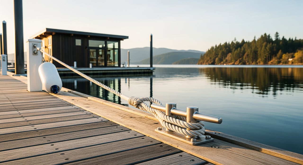
- Mean Lower Low Water (MLLW): The common reference for navigation depth and moorage design. When you plan dock or buoy depths, compare your boat’s draft to depth at MLLW and add a safety margin.
- Mean Higher High Water (MHHW): Often used to locate the legal shoreline and where intertidal areas begin.
Local permitting and design use these datums. You can view definitions and local values on NOAA’s pages noted above.
Tide flats vs deep-water access
Tide flats: what to expect
Some Mason County properties have broad intertidal areas that expose mud or sand at low tide. These flats may include eelgrass, shellfish, or softer sediments.
- Limited boat access at low water. You often need higher tides to launch or retrieve.
- Longer ramps are common if you want a floating dock to reach water at low tide.
- Higher regulatory sensitivity where eelgrass or forage fish habitat is present. Permits may require timing windows and extra review.
- Sedimentation can build up, and maintenance dredging faces significant hurdles.
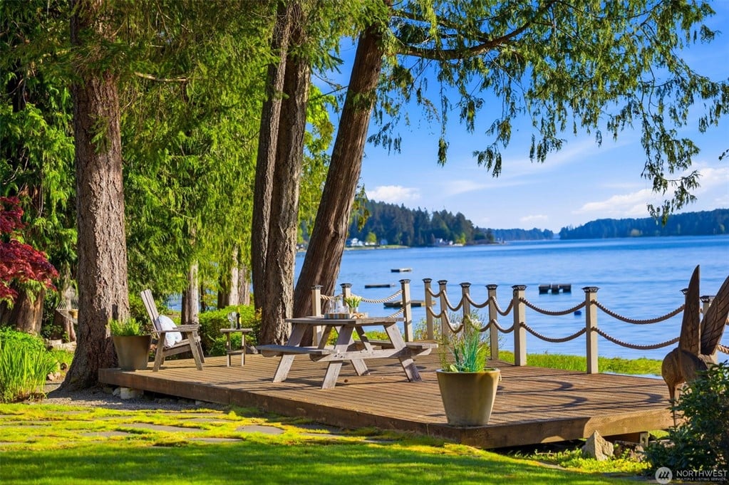
If you love easy beachcombing and don’t need all-tide boat access, flats can still be a fit. Just plan your boating windows around higher tides.
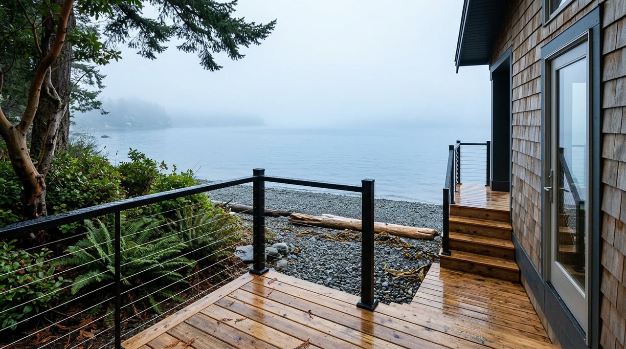
Deep-water access: what to expect
Steeper shorelines can offer usable depth even at low tide. This often means more reliable year-round moorage without extensive dredging.
- Shorter ramps and fewer issues with exposed bottoms.
- Still evaluate wind and wave exposure, especially along longer fetches.
- You may need stronger anchoring or pilings at more exposed sites.
Union, Hoodsport, and Belfair notes
- Belfair: Near river influences and the upper canal, many spots have wider flats and more sediment. Expect larger intertidal areas in some locations.
- Hoodsport: Shore slopes vary. Some properties have steeper nearshore and better low-tide depth, while others include flats. Check each site.
- Union: Conditions vary widely along the shoreline. Always confirm the actual MLLW depth and substrate at the property.
Across all three areas, do not rely on neighborhood generalities. Verify depth at MLLW, the substrate, and any habitat constraints before you buy.
Choosing moorage on Hood Canal
Common options
- Private pier with floating dock: Pilings, a ramp, and a float designed for tidal range.
- Floating-only dock with ramp: Flexible for tides if you maintain enough depth under the float at low water.
- Mooring buoy: Keeps the boat off the beach with less shoreline impact. You need swing room and compliance with rules.
- Community or shared moorage: Shared costs and management through an HOA or agreement.
- Boat lifts or covered structures: Attractive for protection, but closely regulated and sometimes not allowed.
Design fit for your boat
- Draft margin: Confirm depth at MLLW where your boat sits. Add a safety margin, commonly 2 to 3 feet, to cover boat motion, waves, and seasonal shoaling.
- Ramp and float sizing: Longer ramps can be necessary where the beach is shallow. Plan for the horizontal reach at low tide.
- Wind and waves: The canal’s fetch can build chop. Exposed sites may need larger pilings or more robust anchoring. Breakwaters are heavily regulated.
- Shoaling and sediment: Near river mouths and depositional areas, bottoms can shift. Consider long-term access and maintenance needs.
- Utilities and access: Plan for water and power on the float, storage for gear, and parking for guests.
Permits and rules to plan for
Moorage often requires multiple permits. Early conversations save time and money.
- Mason County Shoreline Master Program: Local rules guide dock type, size, and placement.
- Washington Dept. of Fish & Wildlife (WDFW) HPA: Most in-water work needs a Hydraulic Project Approval. See the WDFW HPA program for timing windows and requirements.
- Washington Dept. of Ecology: Shoreline permits vary by project and location. Review Ecology’s shoreline management guidance.
- Washington State DNR: If state-owned tidelands are involved, you may need a lease or authorization. Learn more on DNR’s aquatic lands page.
- U.S. Army Corps of Engineers: Federal permits may apply for structures or any fill or dredging. Start with the Seattle District Regulatory page.
Critical habitats like eelgrass or forage fish spawning areas can shape location, timing, and mitigation. Contact Mason County Planning and Environmental Programs and WDFW early in your process to understand feasibility and work windows.
Buyer checklist you can use today
- Get a site-specific tide and depth profile. Check predictions and recent readings at the closest NOAA Tides and Currents station. Obtain depth soundings or bathymetry at MLLW where moorage would sit.
- Confirm tideland ownership and the shoreline line. Review the deed, plat, and county mapping to understand the MHHW line and whether tidelands are privately or state owned.
- Assess substrate and habitat. Note if the bottom is rock, sand, or mud. Look for eelgrass or shellfish that may limit structures or timing.
- Review existing moorage and paperwork. Verify that docks have active permits. Confirm any recorded easements for shared access.
- Check regulatory feasibility early. Talk with Mason County Planning and Environmental Programs and WDFW. If state tidelands are involved, expect DNR to participate.
- Match boat draft to low-tide depth. Use MLLW depth plus a safety margin to confirm a good fit for your vessel. For a buoy, confirm swing radius and clearance.
- Assess wind exposure and protection. Consider predominant wind directions and fetch. If the site is exposed, plan for more robust design and anchoring.
- Plan for maintenance and costs. Budget for float replacement, deck repairs, piling wear, possible dredging limits, and DNR lease fees if applicable.
- Hire local pros. Engage a marine contractor, surveyor, and coastal consultant experienced with Mason County and Hood Canal.
Using charts and local data
For navigation planning and a first look at nearby shoals or hazards, check NOAA nautical charts and ENC resources. Combine charts with site soundings and your local NOAA station data to form a complete picture of depth and timing at your property.
Putting it all together
The right Hood Canal property depends on how you want to use the water. If you need consistent, all-tide access for a deeper-draft boat, focus on steeper shorelines with depth at MLLW. If you value broad beaches and don’t mind timing your launches, tide flats can still work well. In both cases, early permit planning and a careful depth profile will save you surprises later.
If you want a local, concierge-level guide through the evaluation and permitting landscape, we can help you assess specific lots, existing docks, and depth conditions before you write an offer. Ready to explore Hood Canal waterfront with confidence? Schedule a conversation and we’ll help you align your boating goals with the right shoreline.
Questions about a specific property or dock? Reach out to Unknown Company to schedule a free consultation.
FAQs
What is MLLW and why does it matter for Hood Canal moorage?
- MLLW is the average of the lower low tides and is the common depth reference for moorage; you want MLLW depth plus a safety margin to protect your boat at low water.
How do tide flats affect dock length and boat access in Mason County?
- Flats push the waterline far out at low tide, which can require longer ramps and may limit boating to higher tides unless design and depth are carefully planned.
Which permits are typical for building or modifying a dock on Hood Canal?
- Projects often involve Mason County shoreline permits, a WDFW HPA, possible DNR authorization for state tidelands, and U.S. Army Corps permits if structures or fill are involved.
How can I check tide predictions for a property near Union or Hoodsport?
Are mooring buoys easier to permit than docks on Hood Canal?
- Buoys can reduce shoreline impacts, but they still require approvals and must meet swing room and anchorage rules; feasibility depends on site depth, habitat, and jurisdictional review.